Sunday, December 16, 2012

Boston Common - Boston, MA


There is no debate that Boston Common is a classic masterpiece and an example of an urban park that works and truly functions in every way it should. Boston Common works on so many levels it could essentially be used as a blueprint for other parks and cities to follow. It is one of the prime destinations in one of most America's most essential and important cities, and deservedly so. The fact that it is the oldest city park in the United States, dating from its creation in 1634, makes it all that more impressive. It is as if the designers of this first urban park had the right idea all along.

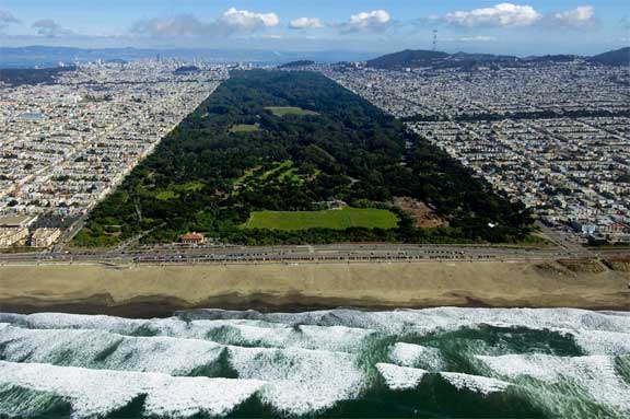
The location of the park contributes heavily to its use and importance. It is located in the heart of Boston on 50 prime acres bounded by Tremont, Park, Beacon, Charles, and Boylston Streets. It is located directly to the west of the heart of downtown and borders many other famous neighborhoods, such as Beacon Hill. The state capitol building of Massachusetts also lies on the edge of the park, adding to the air of importance in the atmosphere. Although it has been in continuous use as public land since the 1630s, its use has changed over time. It started as a common area for many different people to use as a cow pasture, hence the use of the name Common instead of park. For the first two centuries of it existence, it was more used as a shared public space and gathering spot than a true park. For example, the British used the area as a camp for troops in the build-up to the Revolutionary War. Also, the area was a popular spot for public hangings until the early 1800s. By the 1830s, a transition was made towards true park status, a time which coincided with the full removal of cow grazing from its boundaries.

Today, the park plays an essential role in the daily function of Boston. It is a large green space in the middle of a highly dense urban environment. It is an area enjoyed by people all across the socioeconomic spectrum. It is heavily used for exercise, recreation, relaxation, public events, and both formal and informal gatherings. It is also a destination unto itself as part of Boston's famous Freedom Trail winds through its boundaries. The park affords excellent views of the surrounding cityscape and skyline. While the park is well landscaped and features grand monuments, it is relatively simple in design. In many ways, it can be argued that less is better as there is more space for public use and less cost for maintenance on the city's part.

Boston Common serves as a much needed natural oasis in the heart of hectic and crowded Boston life and offers so much more. Not much more can be asked for from an urban park of its size and location.


Saturday, December 15, 2012

Woldenberg Park - New Orleans, LA


New Orleans certainly is known for a number of things, and not all of them are positive. The city, or more specifically the French Quarter section, is known worldwide as a nightlife and partying destination. The dense character of the area, the large quantity of restaurants, bars, and clubs, and the city's incredibly liberal alcohol laws contribute heavily to this atmosphere and reputation. However, the city is also known for it extremely high levels of poverty and urban decay. This reality was hastened and brought into an incredibly harsh limelight by the disastrous effects of Hurricane Katrina in August 2005, which had a devastating impact on the city and region. There are parts of the city, such as the Lower Ninth Ward, that have not recovered and may never will. After the storm, the city experienced a large population decline, and it is doubtful that the city will ever regain the lost population. However, instead of focusing on those problems and Katrina-related issues, this will briefly mention the city's relatively new waterfront, which is a bright spot in the heart of the city.

Woldenberg Park lies on the banks of the Mississippi River in the Upper French Quarter and stretches towards downtown and the Port of New Orleans. It as a great example of turning dilapidated and under-used land into a grand public space and park. The park itself is relatively young, as it was created in the late 1980s and early '90s. The site was previously full of old wharves and warehouses that had been partially abandoned. It was industrial in character and was an intimidating area. Floodwalls, warehouses, and industrial docks dominated and there was essentially no public access to the waterfront in the area. However, New Orleans realized the high amount of potential the site possessed. The location along the waterfront tip of the French Quarter made it a logical space for a public area. By opening up the waterfront to the public, New Orleans added an asset to its arsenal while improving the economic activity and development of the French Quarter and the Downtown area.

The park, like the entire region is flat in character. This makes it accessible to people of all age groups and physical abilities. Paths meander throughout and along the waterfront where people can walk, bike, or jog while enjoying the grand views of the mighty Mississippi River. Public art and sculptures are dotted throughout to add character. Also, there is plentiful green space and shaded areas, which prove mighty useful in the hot and humid Louisiana climate. It is a popular social gathering place and is a prime location for festivals. Also, one can often find street musicians performing in the park, which adds to the colorful atmosphere.


New Orleans is a city struggling with a certain number of issues. However, it cannot be denied that the city has the right idea about its waterfront. The implementation of a public park turned a once foreboding area into a civic highlight. It is an example of immeasurable positive attributes that public space can bring to an area.

Sunday, December 9, 2012

Golden Gate Park - San Francisco, CA


Golden Gate Park in San Francisco is a classic urban park. It serves an invaluable role of providing a massive green and open space in the midst of one the most densely-populated cities in the United States. It is also a classic model of open space design and how it can be successfully integrated into the surrounding community. Although Golden Gate park is located in the western part of the city, away from the main tourist and higher-income areas, it has established itself as an attraction unto itself. Locals and visitors alike now go out of their way to visit Golden Gate Park, and what they experience is a crown jewel in the American urban park system.

Golden Gate Park is very large, with 1,017 acres comprising the total size of it. It is configured as a rectangle, in the same manner as New York's Central park, although Golden Gate is larger. The comparison to Central Park is no accident, as the park is often compared to it. In the late 1800s, residents of the rapidly developing city began to voice their desire for a park similar to the one that was being developed in New York City at the same time. Therefore, the original design s for the park were originally based on a desire to be as similar to Central park as possible. Frederick Law Olmsted, the mind behind Central Park, is often associated with the advent of Golden Gate Park. However, his ideas were merely used as a set of guiding principles in the creation of the park. Carved out of harsh sand dunes in the western part of the city, the park was established in a then-unincorporated section. Although the park was created by promoting open space and recreation opportunities, it actually contributed to the heavy development of the western side of the city, as new neighborhoods sprouted around the boundaries that were set aside. As viewed from the picture above, comparisons to Central Park are certainly inevitable. It is a massive green space squeezed into one of the most densely-populated areas in America.

The park contributes to the quality of life in the western part of the city, particularly the Richmond and Sunset districts, which border the northern and southern ends of the park, respectively. These neighborhoods are often ignored by tourists and actually remain relatively affordable and working-class in a city that has been characterized in recent years and decades by skyrocketing prices across the board. It is an asset that these neighborhoods enjoy such easy access to the jewel of the city park system. The western end of the city by the Pacific Ocean is more often than not blanketed in clouds and fog, even when the rest of the city is covered in sunshine. There are no hills directly on the coast in this area of town to break up the clouds, and therefore they tend to settle in comfortably in this area. This atmosphere at times lends a mysterious quality to Golden Gate, which is heavily forested. Numerous paths wind through the park where one can take in this atmosphere on a stereotypically foggy Bay Area day.


The park is a legendary location, especially in regards to the history of the counterculture and other large gatherings. San Francisco is generally considered to be the epicenter of American free-spiritedness, free thinking, and the counterculture movement that gained fame in the late 1960s. As the largest public park in the city, it became a popular free gathering place for many counterculture activities, a practice that continues to this day. It was the site of the Human Be-In in January 1967 that was a precursor to the Summer of Love, a time in history that marked the hippie movement and forever linked it to San Francisco, the neighborhood of Haight-Ashbury, and Northern California in general. It was a gathering and demonstration that focused the key ideas of the counterculture movement, and it attracted upwards of 30,000 people. To this day, it continues to be a key location of free events and music festivals, among other things.

Besides its historical importance, the park is also a an architectural and landscaping masterpiece. A particular highlight is the Japanese Tea Garden, the oldest public Japanese Garden in the United States. It opened in 1894 and features many peaceful paths and ponds. The park also features Stow Lake, the largest man-made lake of the park. Rowboats and pedal-boats can be rented for public use from a boathouse on the lake. A striking feature of the lake is the presence of Strawberry Hill, a large hill that is now an island in the lake and features an electrically-pumped waterfall. At the top of the hill, incredible views of the city are possible when clear, including a glimpse of the Golden Gate Bridge.


The park is truly an important piece of San Francisco culture. It is one the essential recreational and public gathering places in the city. It offers a much needed natural environment in a dense urban center. Its location comes with a certain number of issues, including high drug activity and a substantial number of homeless encampments. It offers prime resting spot in a city with the highest percentage of homeless people in the country. However, Golden Gate Park continues to hold its place high on the pedestal of premier urban parks in one of the most vital cities in the United States.

Saturday, December 8, 2012

Mount Trashmore Park - Virginia Beach, VA


Mount Trashmore Park in Virgina Beach is an excellent example of adaptively re-using land to create recreation and open space. It is also a prime example of the use of parks as an opportunity to rectify environmental problems and utilize green design tactics in the creation and maintenance process. The park is now among the most popular open space and recreation destinations not only within Virginia Beach, but also the larger Hampton Roads region.

The park was officially opened in 1974 on the site of an abandoned landfill. The site of the park was once one of the largest landfills on the East Coast, as trash from up and down the coast was piled into trenches. However, over time it became clear that Virginia Beach could not continue this trash collecting and disposal in perpetuity. It had a short life span, a high economic cost, and was inclose proximity to residential neighborhoods. Therefore, an effort was put forth to convert the landfill site into a recreational park, with the centerpiece of the park being its namesake, Mount Trashmore, where an artificial hill was created literally out of trash. A mixture of trash and clean soil form the foundation of the mountain. The mountain is actually on top of flammable gas because as trash decomposes, it naturally emits methane gas. This issue was addressed during the design and creation process, as the mountain and park creators made seven locations at the ground level for gases to escape. Later, hollow poles were jammed deep into the mountain that release the gas at synchronized times.

The mountain stands out from the surrounding geography, which is largely flat coastal plains. The anomaly of a rather large hill in this area therefore attracts attention and increases visitors to and users of the park. From the vantage point of Interstate 264, which abuts northern border of the park, it appears as a large grassy knoll appearing out of the flat residential and developed landscape. However, the park offers much more than that. There are perimeter trails and a large freshwater lake on the opposite of the mountain from the interstate. There is also a mountain trail and lake trail for users to enjoy. One of the main highlights of the park is the 72 steps that climb to the top of the mountain. At the top, park users can enjoy a sweeping vista of not only the park, but the surrounding area as well. There is also a hugely popular 24,000 square foot skate park located within its boundaries. Therefore, the park attracts various users from all walks of life.

As the most visited park in Virginia Beach, Mount Trashmore is certainly a success story. It is also an example that other urban areas can hopefully follow. It is possible to transform a blighted area, a physical eyesore, or an environmentally contaminated site. Virginia Beach turned an environmentally harmful site into one that is green and promotes the health of its citizenry. Other cities have followed this path and will continue to do so as the environmental movement continues to gain traction and the scarcity of developable land will force the re-use of contaminated or abandoned land.

Thursday, December 6, 2012

Discovery Park - Seattle, WA


Discovery Park in Seattle is an exemplary model of land preservation in the heart of a highly urbanized environment. It is also a great example of an urban park that has done little or nothing in regards to the alteration of the natural landscape in which it inhabits. Discovery Park sits along the majestic, scenic shores of Elliott Bay, which feeds into the Puget Sound. It presents a classic scene of the rugged Pacific Northwest Shoreline geography. If one were to travel away from the greater Seattle metropolitan area, many of the waterfront vantage points would bear a striking resemblance to the park. The fact that city inhabitants can experience this without leaving the confines of Seattle is truly something for which to be grateful.

Discovery Park, at 534 acres, is the largest public park in Seattle and features over 11.8 miles of trails. It lies on the site of the former Fort Lawton, an old United States Army post. A large majority of this post, the entirety of the park, was given to the city of Seattle in 1973 and was immediately dedicated as a park. It was remarkable that Seattle chose this route, as the park sits on land that would be highly valuable for real estate development. The Magnolia neighborhood, which abuts the park, is one of the more higher-priced and desirable neighborhoods in the city. Seattle understood that it was much more important to preserve this land to promote the interests of citizens and increase the livability and attractiveness of the city as a whole.

The city of Seattle is certainly unique when compared to other similarly sized cities across the United States. An integral part of that has to do with the geographic isolation of the city. It is located in the extreme northwestern corner of the lower 48 part of the United States. Therefore, there are many features of Seattle's climate and natural landscape that make it stand out differ when compared to the rest of the country. Discovery Park largely represents what the Seattle area would feel like if human development had never occurred in this region. A moist maritime coastal climate characterized by abundant light rainfall dominates the area which contributes to the dense forests and meadows on sea cliffs throughout the region. The beaches along these shorelines are not gentle or calm, but instead are marked by rough, cold waters and currents and large amounts of driftwood. Therefore the beaches in the park are much more suited to exploration and quiet contemplation than sun-drenched relaxation.

Discovery Park also offers one of the best vantage points of the city. Looking westward, there are unobstructed views over Puget Sound towards the Olympic Mountain Range. It also possible to see the Cascade Range in the east as well. Discovery Park is a relatively new park when viewed from its official creation date. However, in its natural state, it looks like it has been around forever. And that is the true beauty of it, and land preservation in general.


Temple of the Dog, a one-time Seattle group featuring members of local legends Soundgarden and Pearl Jam, certainly realized the potential and haunting imagery of the park and utilized it in filming the entire video of the early 90s hit song "Hunger Strike". A fitting conclusion:


Tuesday, December 4, 2012

Balboa Park - San Diego, CA


Balboa Park is one of the classic American urban parks. Situated directly north of downtown San Diego in the heart of the urban center of the city, Balboa Park plays an extremely positive and pivotal role in many quality of life indicators in not only its immediate area but the entire city. It is a valuable open space preserve as well as a top cultural destination for the city as well as region. The park contains many of the city's prominent museums, playhouses, and various other cultural attractions. Nearly every sport or recreation opportunity imaginable is offered by facilities throughout the length of the park. Also, not to be overlooked at all, the park is home to the San Diego Zoo, one of the largest, most visited, and respected zoos in the world.

Balboa Park was truly a park that was planned for way ahead of time and before parks were given the importance they are heeded today. In 1835, before California was a state, authorities set aside a 47,000-acre tract  to be used for public recreational purposes, which included the land of Balboa Park. This designation makes the park one of the oldest places in the United States to be dedicated to public recreational usage, and it has not changed to this day. By 1870, the city had made the decision to dedicate a 1,400-acre parcel of land to create Balboa Park. At this time, San Diego was only the second American city to dedicate such a large tract of land to create a public park after New York City, which had recently achieved a similar tactic in the creation of Central Park.

The layout of the park is a masterpiece in cultural landscaping that is adapted perfectly to the particular climate in which it is placed. The park is comprised of many drought tolerant and California native plants, many of which were planted early in the park's history by legendary landscape designer Kate Sessions. This fits perfectly with the Mediterranean climate of San Diego and the Spanish architecture that dominates the main areas of the park. A stunning display of this architecture is viewable all along the main drag of the park, El Prado, which a part of is pictured below:


Balboa Park often flies in the face of many preconceived notions and stereotypes regarding San Diego and the larger Southern California region. Besides the classic Southern California weather, many of its attractions are not what usually attract people to the area or what spring to mind when outsiders or tourists think of preconceived notions regarding the region. It is park highly dependent upon classical architecture, cultural attractions, and urban activity to promote visitors. This is in contrast to the surf and beach lifestyle of which San Diego is so often equated.

No mention of the park can be complete without giving proper attention to the San Diego Zoo, which is situated within its boundaries. An incredible year-round attraction for tourists and locals alike, the zoo is situated on hilly terrain with over 3,700 animals from over 650 species within it. It is one of the largest zoos in the United States and has been a pioneer in implementing the design of cage-free exhibits for the animals. It is also a leader in the conservation and protection of animals.

Balboa Park is a decidedly historic and urban park located in the heart of one of a city that non-locals do not tend to view as very urban. San Diego is a very diverse city,whether it be geographically, ethnically, or in terms of lifestyle. Therefore, Balboa Park and its varied attractions and uses, is the perfect park centerpiece for the city in which it is located.

Sunday, December 2, 2012

Branch Brook Park - Newark, NJ


Newark, New Jersey is a perennially underestimated and overlooked city. Despite its ranking as the highest-populated city in New Jersey and a key geographic location within the New York metropolitan area, the largest in the United States, Newark has often been disparaged and overlooked in recent decades. This largely coincided with the construction of the interstate highway system and the resulting suburbanization of America, where it became desirable for people of higher income to move outside of urban centers to outlying areas where more space, less density, and larger, newer homes were viewed as a benefit. Newark, as one of the major urban centers in the most heavily developed and industrialized region in America, certainly experienced these changes to an exceptional degree. Its declining reputation was further exacerbated by the devastating riots of 1967. As a result, the city became one heavily composed of minorities and immigrants and heavy economic investment in the city heavily decreased. However, despite all of the doom and gloom, Newark was once one of America's greatest cities with all of the grand architecture, amenities, and infrastructure associated with such a title. Many of these landmarks remain and the city has the incredible potential to at least partially reclaim its previous status.

A hallmark of a great city is usually the presence of a grand public or open space system. Throughout Newark are plazas such as Military Park where grand sculptures or statues exist. The anchor of the Newark open space system is Branch Brook Park which is located in the middle of the North Ward of the city, directly north of Interstate 280. Branch Brook Park offers a massive expanse of open space, trails, and recreation facilities, and offers an oasis from the dense and crowded nature that is characteristic of Newark life. The park is mostly flat but there are several gently rolling hills throughout. A true urban park, it is surrounded on all sides by dense city development. Therefore, there is easy access to a large population to enjoy all the benefits it offers.

The park was formally created in 1895 and in 1900 was commissioned to the firm of Frederick Law Olmsted with the mission of redesigning the park, who was the mind behind Central Park in New York City and many other well-known parks. Throughout the southern and central parts of the park, a large skinny waterway is present from which the park derives its name. The northern part of the park is dominated by meadows and a large open field where only the distant sound of traffic reminds one that they are in the middle of urban northern New Jersey as opposed to somewhere in the Pennsylvania countryside. This open space provides an invaluable outlet for people from the surrounding community to exercise, relax, and play sports.

The park is also home the largest collection of cherry blossom trees in the United States located within a common boundary, with over 4,300 trees present in several varieties. They are largely located along the waterway and the various paths that wind around the park. However, the park is hardly mentioned as a major cherry blossom destination on par with the likes of the Tidal Basin in Washington D.C. Nonetheless, the park experiences its largest amount of traffic when the cherry blossoms are in bloom.

Once inside the park it is hard to ignore the presence of Cathedral Basilica of the Sacred Heart, which dominates the view when looking east over the southern part of the park. It gives the park a distinguished, old-world feel. The Cathedral is a gothic-style church that is one of the largest of its kind in the entire United States.

It should be viewed as no coincidence that the Forest Hill neighborhood, which borders the eastern side of the park, is the wealthiest and one of the most desirable neighborhoods in the city. Access to maintained open space of a high quality has an incredibly positive effect on the economic viability of a neighborhood and the city in which it is located. This is a topic that will be given much further attention on further posts. As for now, Branch Brook Park is a great city park with an invaluable role with the potential to be even greater. Perhaps next time one is flying through the middle of Newark on Interstate 280, time will be taken to explore this incredible civic treasure by simply exiting the highway. Here is one more view of the park with the cherry blossoms in bloom: